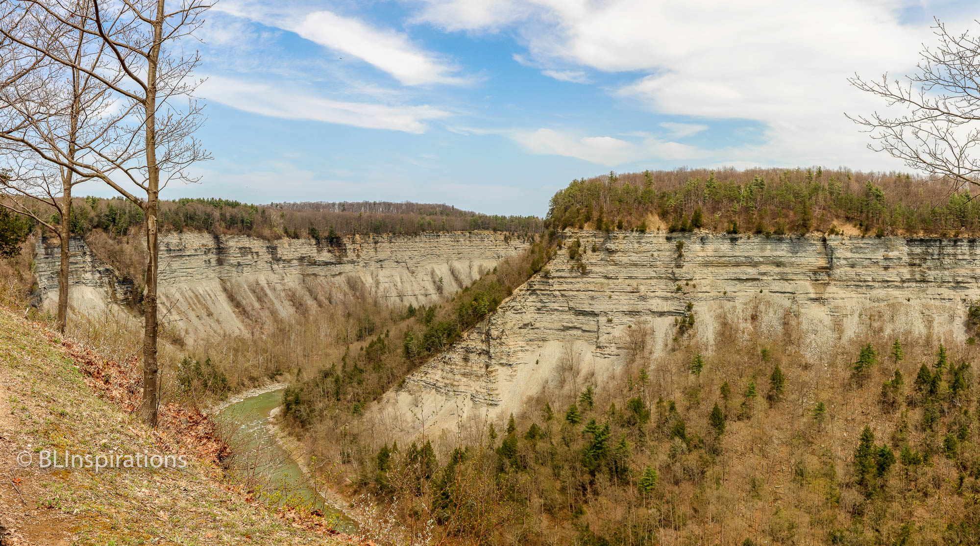
Early in May this year, we visited some of Beverly’s family in New York. While we were there, Beverly and I visited Letchworth State Park with her brother and his wife. This photo shows a typical view of the Genesee River gorge in the park.
Letchworth State Park in western New York, known as the “Grand Canyon of the East,” is a scenically magnificent park. The park is roughly 17 miles long, from Portageville at the southwest end to Mount Morris at the northeast end. The park follows the course of the Genesee River as it flows north through a deep gorge (as deep as 600 feet in some places) and over three major waterfalls which are at the southern end of the park. The rock exposed in the gorge is mostly shale, with some layers of limestone and sandstone. A paved road follows the west side of the gorge providing many scenic viewpoints. The Upper Falls is 70 feet high, the Middle Falls is 107 feet high, and the Lower Falls is 55 feet high. The Upper and Middle Falls are close to each other, while the Lower Falls is 2 miles downstream (north).
The Mount Morris Dam is a concrete flood control dam at the north end of the park. This dam is the largest concrete gravity flood control dam east of the Mississippi River. It is 1,028 feet in length and rises 230 feet from the riverbed. The dam is considered a “dry dam” as the Genesee River normally flows unimpeded through the dam. Only in times of impending floods is the river flow restricted and water backs up in the gorge. The U. S. Army Corps of Engineers states that, in the years since the dam was completed in 1952, an estimated $1 billion in flooding damages have been prevented.
In 2015, Letchworth won the USA TODAY Readers’ Choice Award for Best State Park in the United States. Letchworth came out on top of the 19 other state parks nominated for the contest, chosen from more than 6,000 parks across the nation.
Other posts about Letchworth State Park:
Middle Falls
Upper Falls
Lower Falls
Rock Layers at Letchworth State Park
More Information:
Wikipedia – Letchworth State Park
Wikipedia – Mount Morris Dam
Google Maps – Letchworth State Park
Additional Photos


Technical Daata
Genesee River Gorge 3 Panorama
- Date: 5/5/2018
- Time: 1:23 PM
- Camera: Canon EOS 77D
- Lens: Canon EF-S 17-55 mm, f/2.8 IS USM
- Settings:
- Lens: 21 mm, f/10
- ISO: 400
- Shutter: 1/500 sec
- Cropped image is 9419 px x 5616 px (3 image panorama)
- GPS Coordinates: 42°35’57.298″ N, 78°1’46.318″ W
Genesee River Gorge 1
- Date: 5/5/2018
- Time: 12:47 PM
- Camera: Canon EOS 77D
- Lens: Canon EF-S 55-250 mm, f/4-5.6 IS STM
- Settings:
- Lens: 55 mm, f/10
- ISO: 400
- Shutter: 1/500 sec
- Uncropped image is 4000 px x 6000 px
- GPS Coordinates: 42°36’45.383″ N, 78°0’30.983″ W
Genesee River Gorge 2
- Date: 5/5/2018
- Time: 1:08 PM
- Camera: Canon EOS 77D
- Lens: Canon EF-S 55-250 mm, f/4-5.6 IS STM
- Settings:
- Lens: 100 mm, f/6.3
- ISO: 400
- Shutter: 1/500 sec
- Uncropped image is 4000 px x 6000 px
- GPS Coordinates: 42°36’26.375″ N, 78°1’26.19″ W
Crumbling Rock
- Date: 5/5/2018
- Time: 12:48 PM
- Camera: Canon EOS 77D
- Lens: Canon EF-S 55-250 mm, f/4-5.6 IS STM
- Settings:
- Lens: 60 mm, f/6.3
- ISO: 400
- Shutter: 1/500 sec
- Cropped image is 5542 px x 3695 px
- GPS Coordinates: 42°36’45.383″ N, 78°0’30.983″ W