This post is one of a series about our trip to Arizona and California spanning this past New Year’s holiday. For an overview of our trip and links to other posts, please see 2018/2019 Western Trip.
The Salton Sea is the largest lake in California. It is a shallow, saline lake in the southern California desert, just south of Joshua Tree National Park. It’s surface is about 235 feet below sea level. The lake is only fed by irrigation runoff and rainfall and there is no outflow except for evaporation. As the water level has fallen, the water has gotten saltier because as the water evaporates it leaves behind dissolved salts and other minerals, gradually increasing salinity. It is saltier than the Pacific Ocean, though slightly less salty than the Great Salt Lake in Utah. The Salton Sea is about 15 miles wide and 35 miles long; its long axis runs northwest – southeast.
In 1905, a large amount of water filled the formerly dry lake bed when water from the Colorado River feeding irrigation canals created for farming in the Imperial Valley overwhelmed a canal near Yuma, Arizona. River water flowed into the Salton Basin through a mile-wide flood channel for nearly two years before repairs were completed, creating the current sea and submerging most of the town of Salton. The Salton Sea became a productive fishery during the 1940s, and with post-war wealth, the area became a popular tourist spot in the ’50s, with resorts, beachfront homes, and water skiing.
There is a reservoir of mineral-rich water beneath the southern shore of the Salton Sea, heated to temperatures as high as 700 degrees Fahrenheit by heat from the Earth’s core. The area’s geology allows that heat to rise near the surface, creating geothermal energy hot spots. A number of power plants convert that geothermal energy to electricity, using steam from the super-heated subterranean brine to drive turbines and generators. On a large computer screen, water vapor plumes from geothermal plants are just visible along the horizon in one of the images in the Additional Images section below.
North Shore is an unincorporated town named because of its location along the northeast shore of the Salton Sea. The town was formed in 1958 when developers purchased the land on which the town would sit and began to sell individual parcels. The North Shore Beach and Yacht Club, designed by Albert Frey, opened in 1959 as part of the anticipated resort development. At the time, it was the largest marina in California. Celebrities including Frank Sinatra, Bing Crosby, the Beach Boys, Sonny Bono, Jerry Lewis, the Marx Brothers, and Desi Arnaz flocked to the area. For a while, the “Salton Riviera” rivaled nearby Palm Springs and attracted more tourists than Yosemite National Park, but the anticipated development never materialized. The North Shore Beach and Yacht Club fell into disrepair and closed in 1984; the clubhouse was later restored and is now used as a community center.
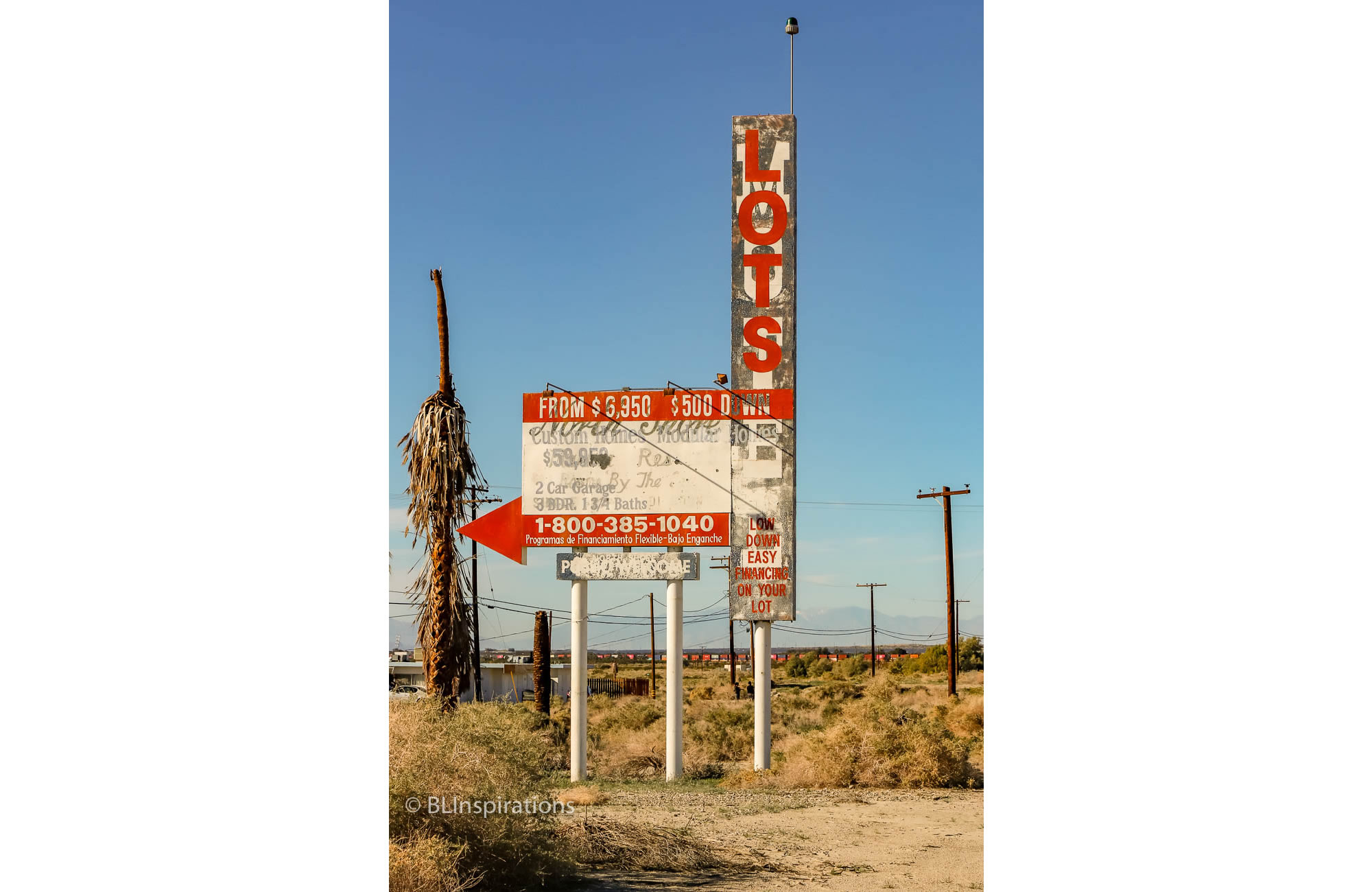
The featured photograph is of a faded sign along the highway in North Shore which, at different times, has promoted two business which are no longer in existence. Originally the North Shore Motel’s sign, it was painted over to advertise $6950 Lots and $59,950 Modular Homes. The motel was razed in 2008 but the sign still remains.
Additional Information:
Salton Sea – Wikipedia: https://en.wikipedia.org/wiki/Salton_Sea
North Shore, CA – Wikipedia: https://en.wikipedia.org/wiki/North_Shore,_California
North Shore Motel (has a picture of the motel in it’s heyday) – Yelp: https://www.yelp.com/biz/north-shore-motel-north-shore
Another photo of the sign from 2014 – http://www.iamnotastalker.com/2014/04/21/the-salton-sea/comment-page-1/
Additional Images


Technical Data
North Shore Sign
- Date: 12/30/2018
- Time: 1:18 PM
- Camera: Canon EOS 77D
- Lens: Canon EF-S 17-55 mm f/2.8 IS USM
- Settings:
- Lens: 52 mm, f/16
- ISO: 200
- Shutter: 1/400 sec
- Cropped image is 3451 x 5177 px
- GPS: 33°31’12.57″ N, 115°56’6.24″ W
Salton Sea – View West
- Date: 12/30/2018
- Time: 9:08 AM
- Camera: Canon EOS 77D
- Lens: Canon EF-S 17-55 mm f/2.8 IS USM
- Settings
- Lens: 17 mm, f/14
- ISO: 200
- Shutter: 1/400 sec
- Cropped image is 4939 x 3293 px
- GPS: 33°28’44.07″ N, 115°53’25.374″ W
Salton Sea – View Southeast 1
- Date: 12/30/2018
- Time: 9:27 AM
- Camera: Canon EOS 77D
- Lens: Canon EF-S 17-55 mm f/2.8 IS USM
- Settings:
- Lens: 28 mm, f/22
- ISO: 200
- Shutter: 1/400 sec
- Uncropped image is 6000 x 4000 px
- GPS: 33°20’52.565″ N 115°43’56.279″ W
Salton Sea – View Southeast 2
- Date: 12/30/2018
- Time: 10:11 AM
- Camera: Canon EOS 77D
- Lens: Canon EF-S 17-55 mm f/2.8 IS USM
- Settings:
- Lens: 28 mm, f/14
- ISO: 200
- Shutter: 1/400 sec
- Uncropped image is 6000 x 4000 px
- GPS: 33°20’45.161″ N, 115°43’44.802″ W