The Outer Banks are a 200-mile string of barrier islands and land spits along the coasts of southeastern Virginia and North Carolina. As barrier islands, they help protect the mainland from storms and flood tides. They start at Virginia Beach in Virginia and extend south along most of the North Carolina coastline to Cape Lookout, near Morehead City. They separate Currituck Sound, Albemarle Sound, and Pamlico Sound from the Atlantic Ocean. From north to south they include Bodie, Hatteras, Ocracoke, and Portsmouth islands.
Because there were many shipwrecks in the shallow waters and shifting sands off the Outer Banks, it has been called the ‘Graveyard of the Atlantic’. As a result, a number of lighthouses were built there to warn mariners and to help identify the coastline and inlets of the Outer Banks.
The Outer Banks are not linked to offshore coral reefs like some other barrier islands; consequently, they often suffer significant beach erosion during storms. Their location projecting out into the Atlantic makes them the most hurricane-prone area north of Florida, for both storms making landfall and storms passing offshore.
There are only three access roads from the US mainland to the major Outer Banks islands: US Rt. 64 and US Rt. 64 Bypass connect to Roanoke Island and then to Bodie Island and US 158 connects directly to Bodie Island. North Carolina Route 12 is a two lane highway that runs most of the length of the Outer Banks and includes several portions that are only serviced by ferry boats. Portions of this road are subject to frequent flooding, shifting sand, and massive erosion, particularly near Rodanthe. In the event of a hurricane evacuation, the limited access and narrow highways are a major problem for those trying to leave the islands.
We visited the Outer Banks in October 2021 following our family visit in Sunset Beach, NC earlier that month (please see our Sunset Beach post for other places we visited during that trip). Our destinations in the Outer Banks included five lighthouses, the Wright Brothers National Memorial, which is a National Park in Kill Devil Hills, and Jockey’s Ridge State Park, which is the location of the tallest living sand dune on the Atlantic coast.
We returned to the Outer Banks for a Bluegrass Festival a year later in October 2022 and one thing we noticed during both visits was major highway construction to improve traffic flow and minimize weather-related closures. There are photographs of several of these projects with descriptions in the Additional Images section below.
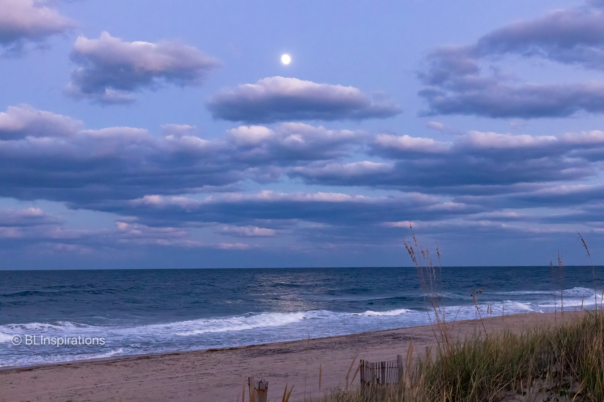
The featured image is the full moon over the beach behind the motel where we stayed in Kill Devil Hills, NC. There are other typical Outer Banks photos from both visits in the Additional Images section below.
As we add photos of the various locations from our 2021 trip we will link them here:
- Bodie Island Lighthouse
- Cape Hatteras Lighthouse
- Hatteras – Ocracoke Ferry
- Ocracoke Lighthouse
- Jockey’s Ridge State Park
- Wright Brothers National Memorial
- Roanoke Marshes Lighthouse
- Currituck Beach Lighthouse
Additional Information
Google Maps: Outer Banks
Wikipedia: Outer Banks
HDR, Inc.: Marc Basnight Bridge
CoastalReview.org: Rodanthe “Jughandle” Bridge
Additional Images
These are a few images from the Outer Banks that are not part of another post.
The Lindsay C. Warren bridge is a 2.8 mile causeway which carries US Rt. 64 across the Alligator River. It has only a 14 ft. clearance over the water at the rotating center span, which takes about five minutes to open or close. As we approached the center span, it had opened to allow a tugboat and barge to pass. The first image shows the barge and tugboat approaching the bridge; the second image shows the open span with the tugboat in the bridge opening. (Note: construction on a high-rise replacement bridge is planned to start in the Summer/Fall 2024.)
The sand dunes at Jockey’s Ridge State Park are extremely large, compared to what is frequently found along the ocean shore. The fourth image shows a small portion of the sand dunes with several people in the lower left, which helps visualize the size of the pictured sand dune.
The fifth image is of the Marc Basnight Bridge which carries NC Rt. 12 across the Oregon Inlet between Bodie and Hatteras Islands. It is 2.8 miles long and replaced the Herbert C. Bonner Bridge which was 58 years old and had suffered from extreme weather deterioration and maritime collisions. The new bridge had opened just several weeks before this photo was taken and Bodie Island Lighthouse with its black and white horizontal stripes is barely visible to the right, 4.1 miles away.
The sixth image is of the Rodanthe “Jughandle” Bridge construction which would replace the stretch of NC Rt. 12 near Rodanthe. That section of highway passed through the Pea Island National Wildlife Refuge and was frequently affected by drifting sand and flooding. Instead of traveling on Hatteras island, it bypasses the island just to the west over the Pamlico Sound. It opened in July 2022 and we crossed it when we were there in October 2022.
The last two images are aquatic birds we saw near near Wanchese, NC a year later in October 2022.


Technical Information
Tugboat and Barge on Alligator River
- Date: 10/17/2021
- Time: 5:26 PM
- Camera: Canon EOS 77D
- Lens: Canon EF-S 17-55 mm f/2.8 IS USM
- Settings:
- Lens: 55 mm, f/11
- ISO: 400
- Shutter: 1/250 sec
- Cropped image is 4542 x 3028 px
- GPS: 35°54’1.0408″ N 76°0’24.2054″ W
Tugboat and Barge passing through US Rt. 64 bridge
- Date: 10/17/2021
- Time: 5:28 PM
- Camera: Canon EOS 77D
- Lens: Canon EF-S 17-55 mm f/2.8 IS USM
- Settings:
- Lens: 31 mm, f/11
- ISO: 400
- Shutter: 1/640 sec
- Cropped image is 5911 x 3941 px
- GPS: 35°54’1.0408″ N 76°0’24.2054″ W
Full Moon over the Beach in Kill Devil Hills
- Date: 10/17/2021
- Time: 6:41 PM
- Camera: Canon EOS 77D
- Lens: Canon EF-S 17-55 mm f/2.8 IS USM
- Settings:
- Lens: 28 mm, f/6.3
- ISO: 3200
- Shutter: 1/30 sec
- Uncropped image is 6000 x 4000 px
- GPS: 36°0’57.9″ N 75°39’24.8″ W
Jockey’s Ridge State Park
- Date: 10/19/2021
- Time: 11:58 AM
- Camera: Canon EOS 77D
- Lens: Canon EF-S 17-55 mm f/2.8 IS USM
- Settings:
- Lens: 55 mm, f/11
- ISO: 200
- Shutter: 1/640 sec
- Uncropped image is 5702 x 3801 px
Marc Basnight Bridge
- Date: 10/18/2021
- Time: 10:31 AM
- Camera: Canon EOS 77D
- Lens: Canon EF-S 17-55 mm f/2.8 IS USM
- Settings:
- Lens: 23 mm, f/13
- ISO: 100
- Shutter: 1/250 sec
- Cropped image is 5825 x 3883 px
Rodanthe “Jughandle” Bridge Construction
- Date: 10/18/2021
- Time: 10:58 AM
- Camera: Canon EOS 77D
- Lens: Canon EF-S 55-250 mm f/4-5.6 IS STM
- Settings:
- Lens: 38 mm, f/13
- ISO: 100
- Shutter: 1/250 sec
- Uncropped image is 6000 x 4000 px
Great Blue Heron near Wanchese, NC
- Date: 10/22/2022
- Time: 10:10 AM
- Camera: Canon EOS 77D
- Lens: Sigma 70-200 mm f/2.8 DG OS HSM
- Settings:
- Lens: 200 mm, f/11
- ISO: 400
- Shutter: 1/250 sec
- Uncropped image is 6000 x 4000 px
- GPS: 35°50’8.6059″ N 75°37’10.3297″ W
Great White Egret near Wanchese, NC
- Date: 10/22/2022
- Time: 10:09 AM
- Camera: Canon EOS 77D
- Lens: Sigma 70-200 mm f/2.8 DG OS HSM
- Settings:
- Lens: 200 mm, f/11
- ISO: 400
- Shutter: 1/200 sec
- Uncropped image is 6000 x 4000 px
- GPS: 35°50’8.6059″ N 75°37’10.3297″ W