Tomahawk Pond is a 2-acre pond in Shenandoah County, Virginia, in the George Washington and Jefferson National Forests. Tomahawk Pond is located on Runions Creek Rd. (Rt. 610) about 9 miles north of Brocks Gap Rd. (Rt. 259) or about 3 miles south of Orkney Springs, Virginia.
We first saw signs for Tomahawk Pond as we were driving to the Shenandoah Valley Music Festival in Orkney Springs and later we looked into it and visited on a sunny day this past September.
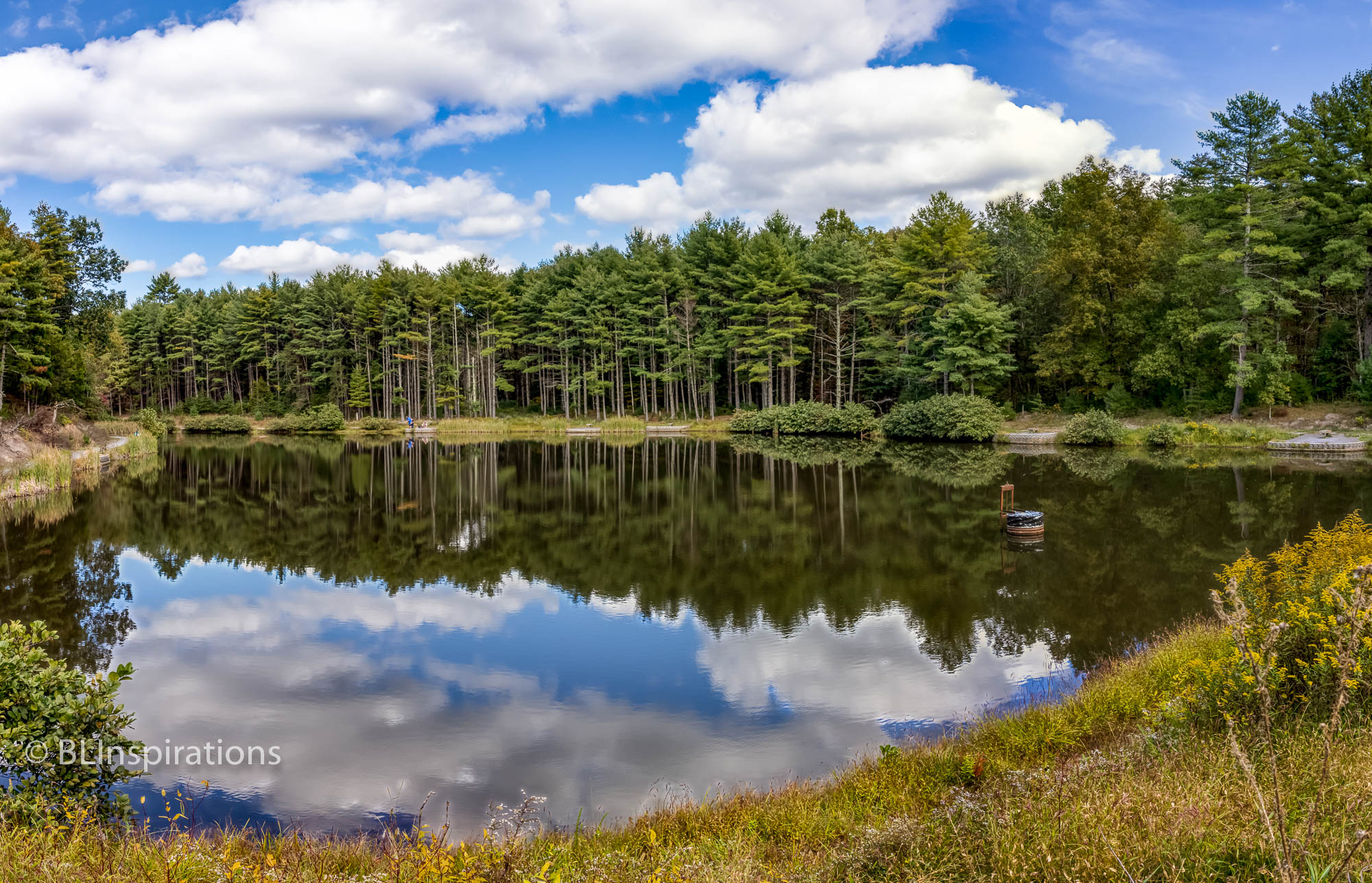
The pond is surrounded by gravel trails, including over the top of the dam, although the trail over the dam was overgrown. There are a number of fishing platforms on both sides of the pond. When we visited there was very little wind so we were fortunate to see very clear reflections of the trees and clouds on the water.
The area has a large number of mounds which are formed by Allegheny mound ants. Information posted about the ants on the park notice board says that they are very aggressive if disturbed. There is a photo of the warning sign and photos of some mounds and ants in the Additional Images section below.
We should mention that there are two entrances to Tomahawk Pond. The northern entrance is for the pond itself and just has parking spaces and no facilities. The southern entrance is for a picnic area but it is not maintained. The tables are in underbrush and the restrooms were locked. Both entrances provide trails to the pond.
The featured image is an HDR Panorama made from nine separate photographs. The panorama consists of three HDR images, each of which is a combination of three separate images taken at three different exposures. (For an explanation of these techniques, please see the Definitions page.)
More Information
Tomahawk Pond (Shenandoah Valley Virginia Fishing Blog)
Allegheny mound ants (Wikipedia)
Additional Images


Technical Data
Tomahawk Pond 1
- Date: 9/27/2020
- Time: 3:10 PM
- Camera: Canon EOS 77D
- Lens: Canon EF-S 17-55 mm f/2.8 IS USM
- Settings:
- Lens: 17 mm, f/6.7
- ISO: 400
- Shutter: 1/180 sec
- Cropped image is 7535 x 4848 px
- GPS: 38°45’32.99″ N, 78°50’26.76″ W
Tomahawk Pond 2
- Date: 9/27/2020
- Time: 3:19 PM
- Camera: Canon EOS 77D
- Lens: Canon EF-S 17-55 mm f/2.8 IS USM
- Settings:
- Lens: 18 mm, f/6.7
- ISO: 400
- Shutter: 1/180 sec
- Uncropped image is 3961 x 5913 px
- GPS: 38°45’32.99″ N, 78°50’26.76″ W
Allegheny Mount Ant Mounds
- Date: 9/27/2020
- Time: 3:24 PM
- Camera: Canon EOS 77D
- Lens: Canon EF-S 17-55 mm f/2.8 IS USM
- Settings:
- Lens: 28 mm, f/6.7
- ISO: 400
- Shutter: 1/500 sec
- Cropped image is 4507 x 2999 px
- GPS: 38°45’32.99″ N, 78°50’26.76″ W
Allegheny Mount Ants
- Date: 9/27/2020
- Time: 3:31 PM
- Camera: Canon EOS 77D
- Lens: Canon EF-S 17-55 mm f/2.8 IS USM
- Settings:
- Lens: 55 mm, f/6.7
- ISO: 400
- Shutter: 1/350 sec
- Uncropped image is 3924 x 5847 px
- GPS: 38°45’32.99″ N, 78°50’26.76″ W