This post is one of a series about our trip to Arizona and California spanning this past New Year’s holiday. For an overview of our trip and links to other posts, please see 2018/2019 Western Trip.
The elevation of Joshua Tree National Park varies from 900 ft. to over 5000 ft. above sea level. Throughout the park, there are hills and mountains of dark brown rock called Pinto gneiss (pronounced nice) that was formed from thick sediment layers that accumulated under ocean waters which once covered the area. Over time, these layers were compressed and fused into sedimentary rock.
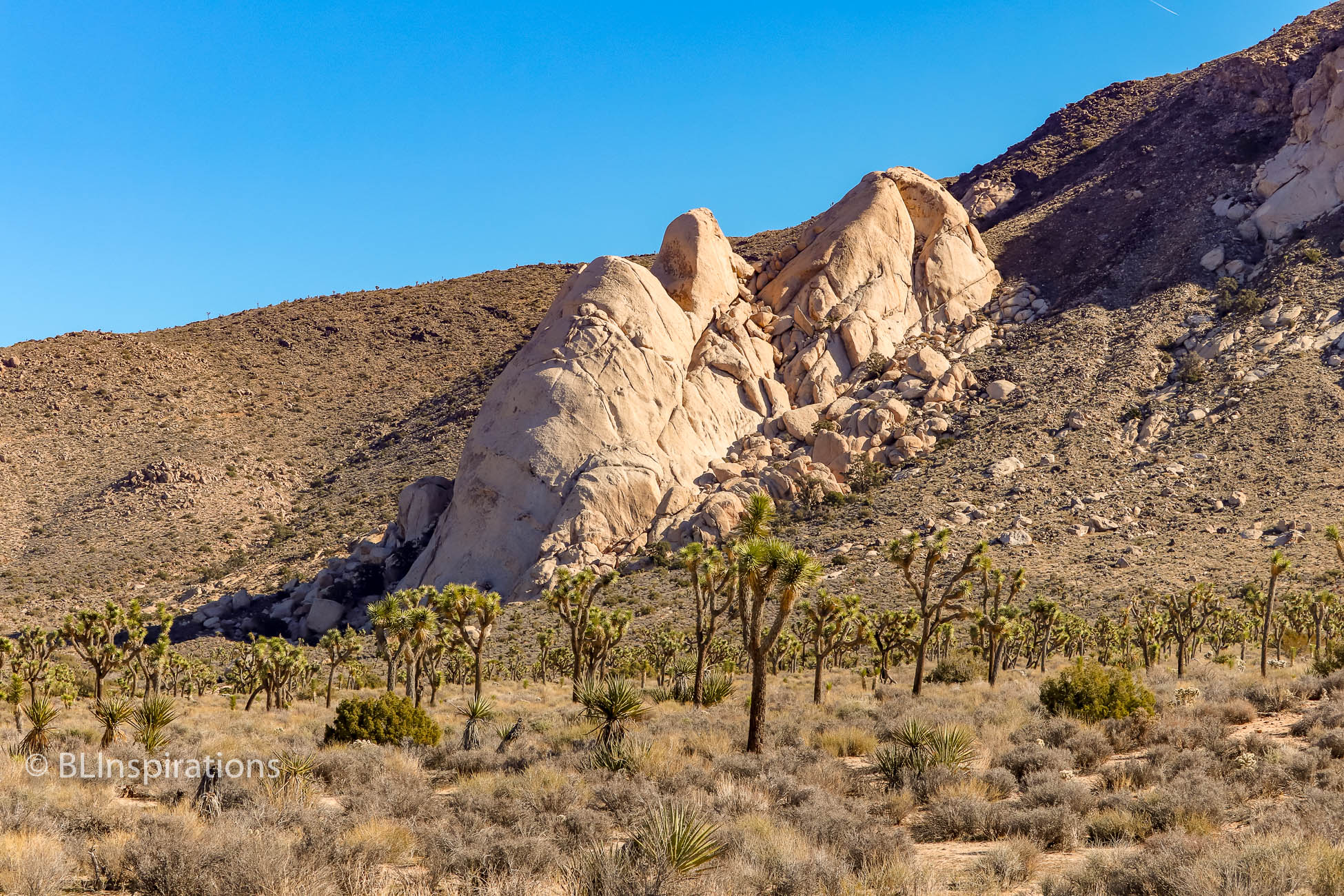
Also throughout the park there are jumbled piles and outcroppings of a lighter colored rock, which is granite. The granite outcroppings were initially formed by molten rock forcing its way through the gneiss. As the molten granite cooled, it cracked to form loose joints in the rock formations. Then, as the surrounding soils were slowly eroded away, the joints expanded, and the granite became rounded, almost as if a sanding block was used to take their edges off. While much of the central core remained intact, many of the outer edges broke off to create the rubble seen today.
In the Additional Images section below, the rock climbers are climbing Intersection Rock.
Additional Information
Geologic Formations of Joshua Tree (National Park Service)
Joshua Tree National Park Geology (Wikipedia)
Additional Images


Technical Data
Granite Outcrop in Gneiss
- Date: 12/29/2018
- Time: 11:00 AM
- Camera: Canon EOS 77D
- Lens: Canon EF-S 55-250 mm, f/4-5.6 IS STM
- Settings:
- Lens: 55 mm, f/10
- ISO: 200
- Shutter: 1/400 sec
- Uncropped image is 4000 x 6000 px
- GPS: 33°59’32.4″N, 116°09’00.1″W
Pinto Gneiss
- Date: 12/29/2018
- Time: 8:39 AM
- Camera: Canon EOS 77D
- Lens: Canon EF-S 55-250 mm, f/4-5.6 IS STM
- Settings:
- Lens: 250 mm, f/22
- ISO: 400
- Shutter: 1/320 sec
- Cropped image is 5984 x 3951 px
- GPS: 34°5’36.048″ N, 116°15’53.472″ W
Granite & Gneiss 1
- Date: 12/29/2018
- Time: 9:00 AM
- Camera: Canon EOS 77D
- Lens: Canon EF-S 55-250 mm, f/4-5.6 IS STM
- Settings:
- Lens: 55 mm, f/7.1
- ISO: 100
- Shutter: 1/320 sec
- Uncropped image is 6000 x 4000 px
- GPS: 34°3’20.5″ N, 116°13’13.099″ W
Granite Rocks 1
- Date: 12/29/2018
- Time: 9:00 AM
- Camera: Canon EOS 77D
- Lens: Canon EF-S 55-250 mm, f/4-5.6 IS STM
- Settings:
- Lens: 55 mm, f/6..3
- ISO: 100
- Shutter: 1/320 sec
- Cropped image is 5359 x 3573 px
- GPS: 34°3’20.5″ N, 116°13’13.099″ W
Granite & Gneiss 2
- Date: 12/29/2018
- Time: 9:01 AM
- Camera: Canon EOS 77D
- Lens: Canon EF-S 55-250 mm, f/4-5.6 IS STM
- Settings:
- Lens: 55 mm, f/10
- ISO: 100
- Shutter: 1/320 sec
- Uncropped image is 4000 x 6000 px
- GPS: 34°3’20.962″ N, 116°13’12.929″ W
Granite Rocks 2
- Date: 12/29/2018
- Time: 9:09 AM
- Camera: Canon EOS 77D
- Lens: Canon EF-S 55-250 mm, f/4-5.6 IS STM
- Settings:
- Lens: 100 mm, f/4.5
- ISO: 100
- Shutter: 1/320 sec
- Uncropped image is 6000 x 4000 px
- GPS: 34°2’21.1″ N, 116°11’31” W
Rock Climbers 1
- Date: 12/29/2018
- Time: 9:51 AM
- Camera: Canon EOS 77D
- Lens: Canon EF-S 55-250 mm, f/4-5.6 IS STM
- Settings:
- Lens: 135 mm, f/16
- ISO: 100
- Shutter: 1/200 sec
- Uncropped image is 6000 x 4000 px
- GPS: 34°0’50.1″ N, 116°9’45.1″ W
Rock Climbers 2
- Date: 12/29/2018
- Time: 9:52 AM
- Camera: Canon EOS 77D
- Lens: Canon EF-S 55-250 mm, f/4-5.6 IS STM
- Settings:
- Lens: 55 mm, f/14
- ISO: 100
- Shutter: 1/200 sec
- Uncropped image is 4000 x 6000 px
- GPS: 34°0’50.1″ N, 116°9’45.1″ W